Ukraine 2010 trip report - Finding the summit
We woke up early in the morning and I started making breakfast while Inna packed her stuff to the backpack. We ate noodles and pâté and I didn't like the taste too much. About three hours after waking up we started the hike with our backpacks full of fresh water from the stream. Almost two hours later we finally found our way out from the forest and I noticed that I had the first tick ever stuck in my arm. Inna was brave enough to dig the fucker out and it seems like she was in time because I didn't get any nasty disease or infection.
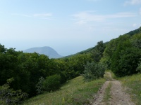
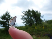
Getting out from the forest really cheered us up because the weather was perfect and the views even better! The Black Sea on one side and green hills with many colorful flowers on the other really made it worth all the climbing. We knew that we had a long hiking day ahead of us so we kept on walking in good mood. Only once we had a longer pause for drinking and eating something fast. During this break a beautiful photogenic butterfly decided to delight us with its presence.
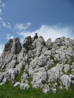
What made the hike special was the absence of other people. We were completely alone and we could see everything within perhaps two kilometers at all times. At one point I climbed a small rock formation and tried yelling from the top. It was like a natural amphitheatre with a nice strong echo. Along the path we saw some animal droppings and we knew that deers live in the area but unfortunately we didn't see any. Probably my yelling didn't help the cause at all.
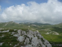
Our hiking route followed almost the highest possible line along the mountain range. If we weren't at the highest point then we at least usually saw it. Based on the map we thought that we'd be hiking on rough, rocky surface but instead grass and flowers grew all over the place and we didn't have to touch rocks with our feet at all if we didn't want to. During our combined lunch / dinner break a thick familiar mist surrounded as and not long after that the rain started. And again it wasn't just some small nice cooling summer rain but a pretty cold shower-like downpour. Suddenly visibility decreased from two kilometers to twenty meters and as we didn't have any map bag, we had to hide the map in a jacket pocket. Combine those two and this is what happened: we missed the path to the summit. The best thing was that we didn't even notice it before the rain ended about an hour and maybe two or three kilometers later.
When we finally found out where the actual summit is, the night was already falling and we needed to find water and a place for our tent. We checked the closest water sources in our map and started walking. We walked for about three kilometers back and forth and we didn't find any water. There were supposed to be two separate streams or springs but we for sure didn't find them. We had some water left from the morning but we knew that during the next day we'd have to find more or stop hiking. We pitched our tent in long wet grass as we didn't find any better place for it and started sleeping.

Admiring the scenery

It's a spider!

At this point I started to hate fog already.

After the rain...

...everything's beautiful.

This route was marked as a road for cars in our map.


Comments